Tutorials
It is easy to get started with GeoJS. There is also an extensive API with numerous options for more sophisticated visualizations, too. See the tutorials below.
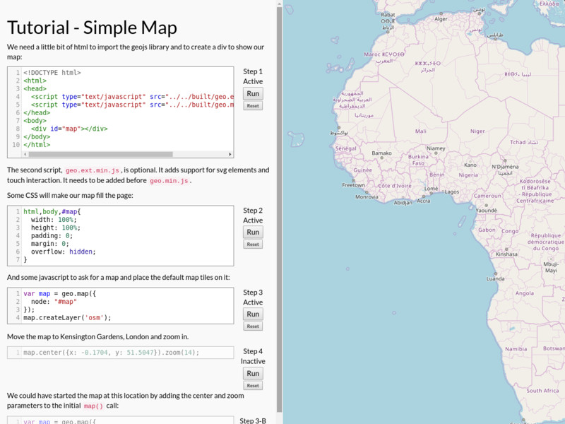
The Simple Map tutorial is a good place to begin. It contains the bare-minimum html, css, and javascript to draw a map.
Make a simple map. Includes HTML, CSS, and Javascript.
Simple Map

Add points to a map
Simple Point
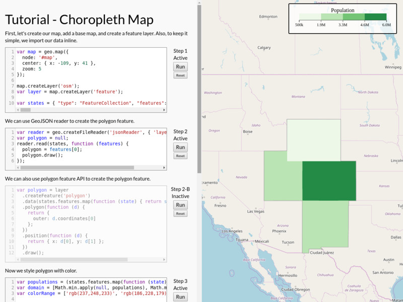
Create a choropleth map, set the colors used, and add a legend.
Choropleth
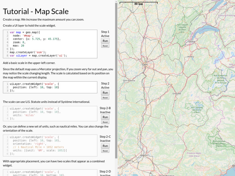
Show scale on a map using a variety of options.
Map Scale
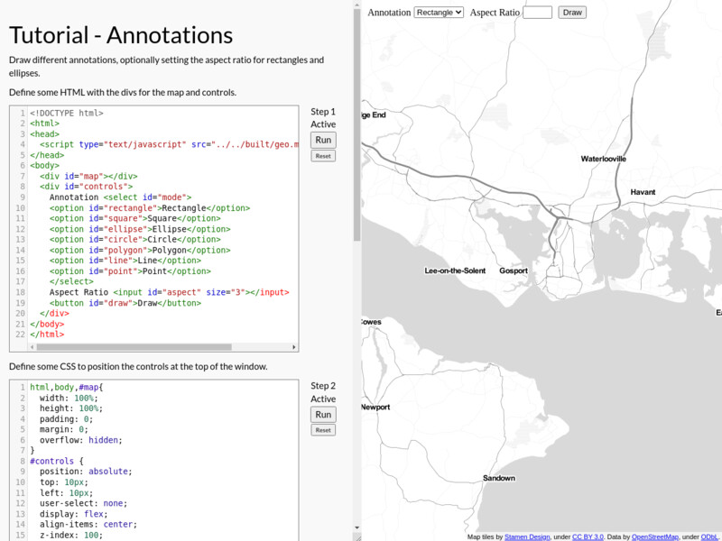
Draw different annotations, optionally setting the aspect ratio for rectangles and ellipses
Annotations
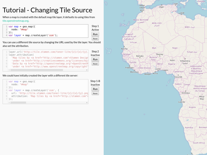
Make a simple map and change the tile source.
Changing Tile Source
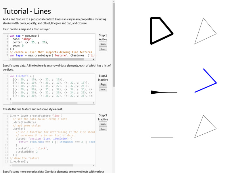
Place lines with different styles in a geospatial context.
Lines
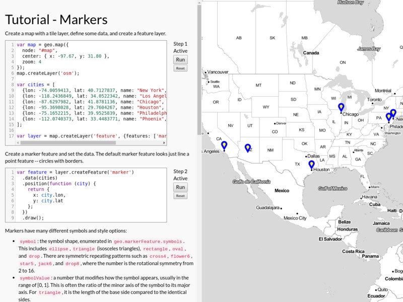
Use markers with different styles.
Markers
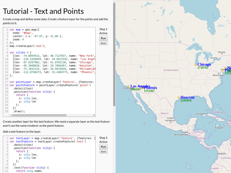
Add text labels and points to a map
Text and Points
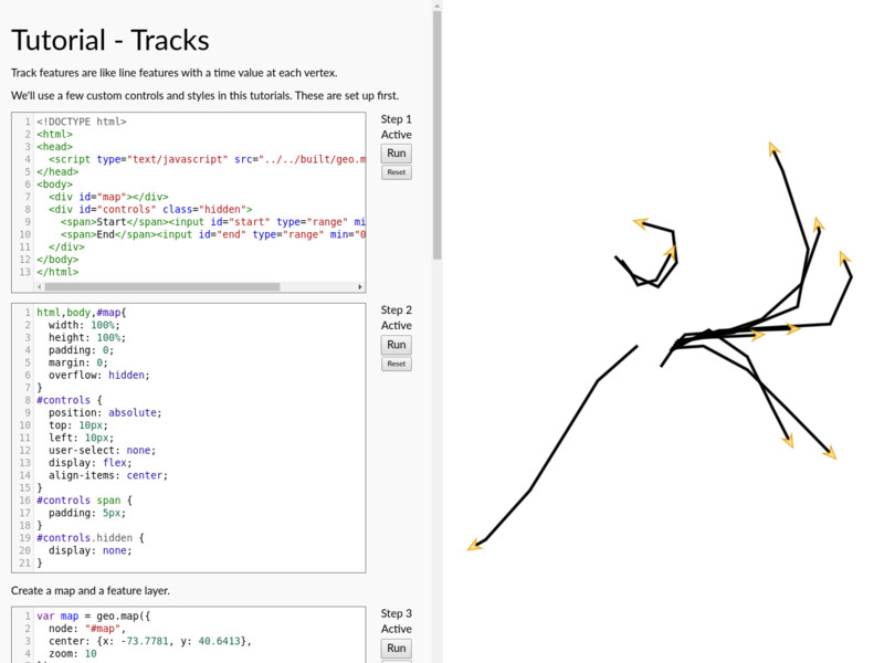
Track features are much like line features with a time value per vertex. A start and end time can be specified.
Tracks
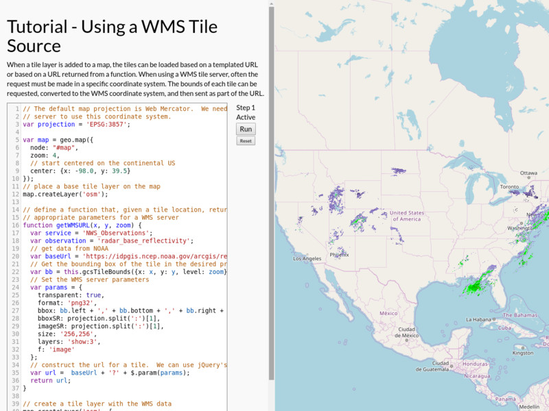
Make a map with a custom function for getting tiles from a WMS server. This also shows how to get tile bounds in different coordinates.
Using a WMS Tile Source
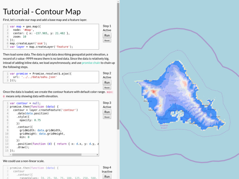
Plot grid data as a color contour.
Contour Map
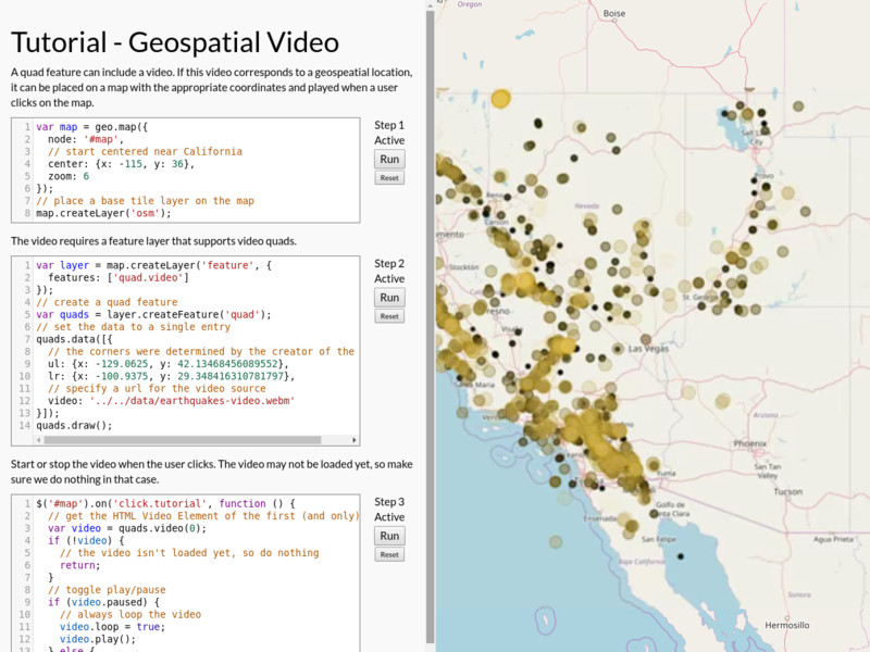
Place a video quad on a map with the correct geospatial location. This shows how to make a video quad and start it playing from a user action.
Geospatial Video
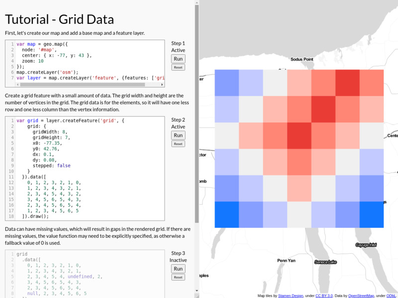
Plot grid data where each grid element is a solid color.
Grid Data
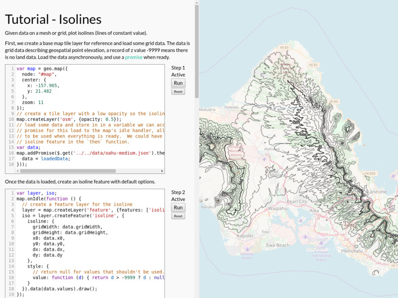
Draw isolines based on scalar grid values.
Isolines
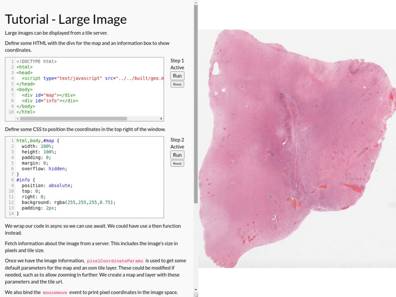
Show a large image from a tile server.
Large Image
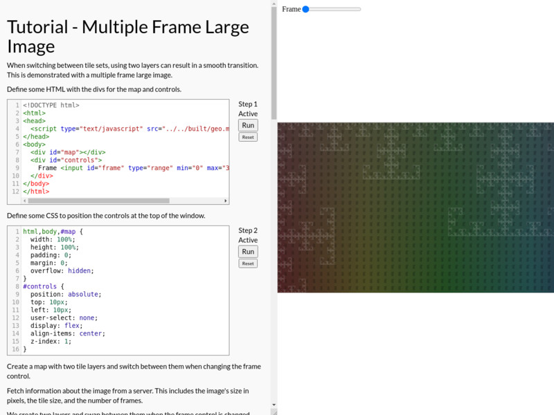
Use two layers to form an A/B buffer when switching between frames of a large image from a tile server.
Multiple Frame Large Image
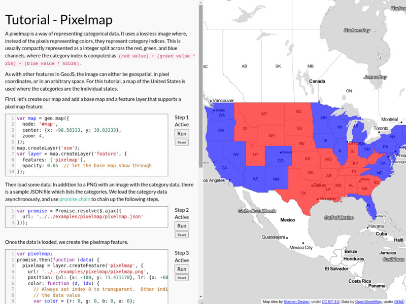
Render categorical data via a pixelmap.
Pixelmap
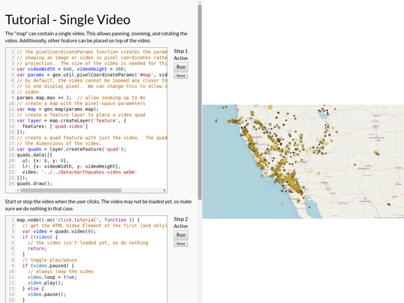
Fill the complete extent of the map with a single video. Draw a polygon on it.
Single Video

Use data arrays as the texture of a quad.
Texture Quads
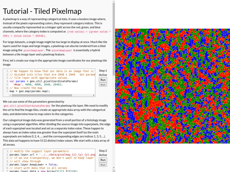
Render large categorical data via a tiled pixelmap.
Tiled Pixelmap
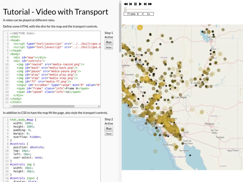
Show a video with controls for playback speed and frame.
Video with Transport Controls
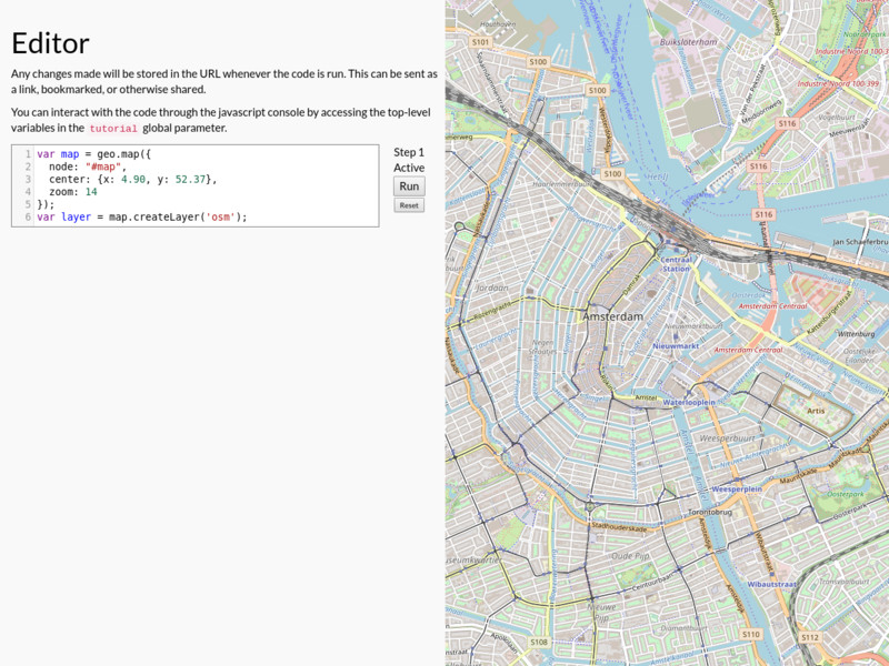
Edit and save work in URL.
Editor
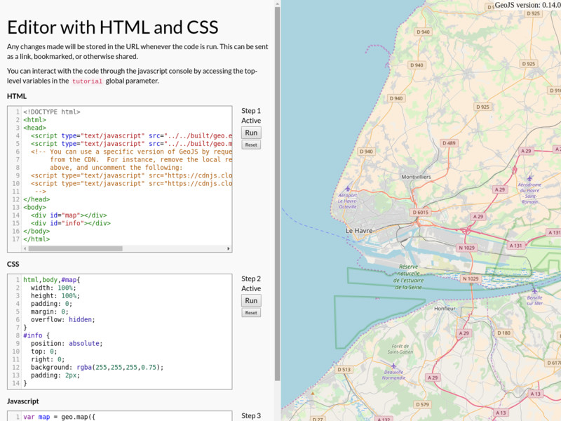
Edit and save work in URL. Edit the HTML to try different versions of GeoJS.